
The New York Times published a map of every building in America last weekend.
Patterns of black dots representing buildings from New York to California “evoke questions – sometimes, simply, what’s that?” and sometimes the questions lead to other questions about culture and history.
Online, you can zoom in on Port Washington to explore our local history.
I have three observations that are only the tip of the iceberg in terms of what can be learned from this map.
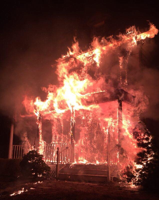
The first is a black dot for a building that isn’t there anymore; then there’s a blank space in the middle of a grid pattern, and finally a black dot much larger than I expected.
The Times deserves a pass for mistakenly including a dot for the Baxter House that was finally demolished about a year ago. Let’s consider it a way to preserve our memory. In fact, it did inspire me to pay a visit to the grounds to do just that.
Eerie it is to stand where this landmark once stood, but what a view! I could imagine the Baxters sitting on their porch in the evening looking out over the bay.
Likewise, it makes sense that in pre-colonial times, the Mattinecock Tribe would settle on this elevated site. Speaking of eerie, could I have been standing above native American artifacts?
The old stone wall in front of the former homestead is still in place. Surely, it too would have been demolished along with the homestead were it part of the private property.
Will the Town of North Hempstead or the Village of Baxter Estates take steps to preserve this surviving reminder or will it too be destroyed? Would we rather forget the tragic demise of the Baxter House?
On Manhasset Isle, a white space interrupts a grid pattern of homes. In most cases, empty spaces on the map are occupied by green parks or golf courses. In Manorhaven, it’s an 11-acre area known as a “brown site” – an idle parcel of land suspected to be polluted by past industrial use. There are said to be 6,000 such sites on Long Island.
Our brown site has historical significance as the location of an airline terminal and manufacturing plant for the likes of Pan American World Airways and Grumman Aircraft. Indeed, Port Washington played a significant role in the growth of the aviation industry. One landmark day came on June 28, 1939, when 5,000 people came to see the Dixie Clipper take off from Manhasset Bay for Europe. It was the first trans-Atlantic passenger flight in history.
These days the area looks like it could be a nature preserve, but for a fence surrounded by a second fence letting a potential visitor such as myself know to keep out. What is to become of this site is major controversy in Manorhaven, pitting concerns of local citizens against residential developers.
The outcome could be aptly revealed on a future version of the map. Will the white space be filled with a dotted pattern in harmony with the surrounding area? Or will there be denser black rectangles of an apartment complex?.
Finally, one building on the map is larger than I expected. I should have known for I had recently visited the Port Washington Tennis Academy myself to present them with a Historic Designation Plaque to honor their service to the community since 1966.
I learned they have the largest indoor tennis facility on the East coast. On the map, it extends from Harbor Road to Lion’s field, and seeing it relative to other buildings, I realized that it is among Port’s largest.
This barely scratches the surface. You may be interested in a small group of histo-nerds that meet at the Sands-Willets House to talk about the relationship of buildings, culture, and history. Our next gathering will focus on an image of the “11050” section of the map. The only requirement to join the conversation is curiosity. Email ross@cowneck.org or call (516) 365-9074 for more information.
Ross Lumpkin is a trustee at the Cow Neck Historical Society.